Hello world!
March 12, 2019Nautical Reference vs. Plotting Charts: Which One Do You Really Need?
February 4, 2026Hey there, boater. Let's talk about something important.
GPS is great. Until it isn't. Electronics fail. Batteries die. Satellites lose signal. What happens then?
You need a backup. A reliable one. That's where physical nautical charts come in.
We've been in the boating business for over 35 years. We've seen technology change. We've watched GPS become standard. But one thing stays the same. Smart boaters carry physical charts.
GPS Fails More Often Than You Think
It happens. You're miles offshore. Your chartplotter goes dark. Maybe it's a power issue. Maybe it's water damage. Maybe the satellite signal just dropped.
Now what?
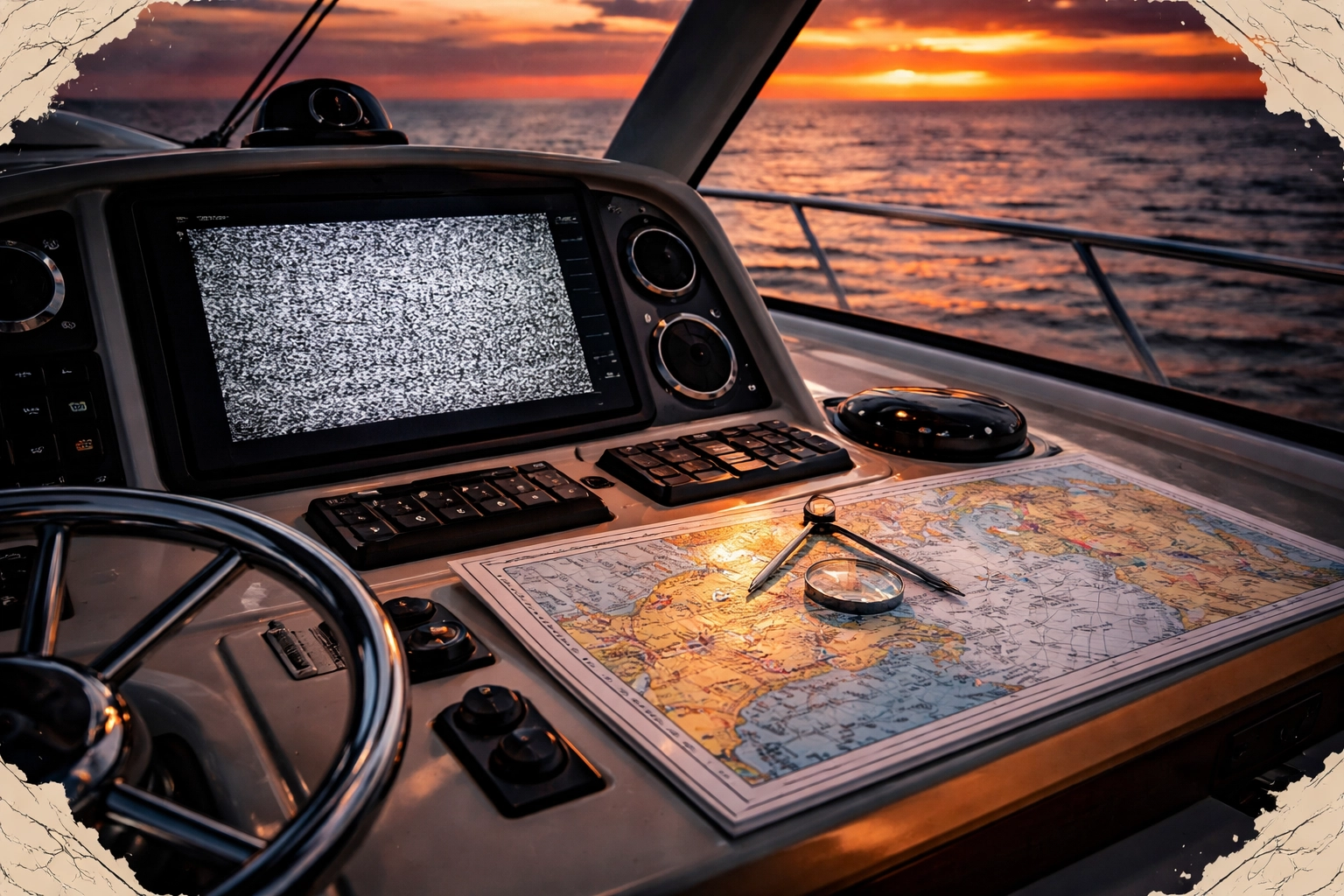
Electronic charts are common today. Most boats have them. But relying solely on electronics is risky. The Coast Guard knows this. That's why regulations still require charts on commercial vessels.
Physical charts don't need batteries. They don't need satellites. They don't crash or freeze. They just work.
Every experienced captain knows this. Your GPS is your primary. Your physical chart is your essential backup.
The Problem With Traditional Paper Charts
Old-school paper charts have issues. They're big. They're bulky. They tear. They get wet and fall apart.
Ever tried to unfold a large rolled chart in the cockpit? Wind catches it. It blows everywhere. Good luck reading it while waves are crashing.
Storage is another headache. Rolled charts take up space. They don't fit in small compartments. They get damaged in storage.
We solved these problems.
Waterproof, Laminated, and Built for Real Conditions
Our charts are different. They're waterproof. They're laminated. They handle anything the sea throws at them.
Rain? No problem. Spray? Wipe it off. Drop it in a puddle? Pick it up and keep navigating.
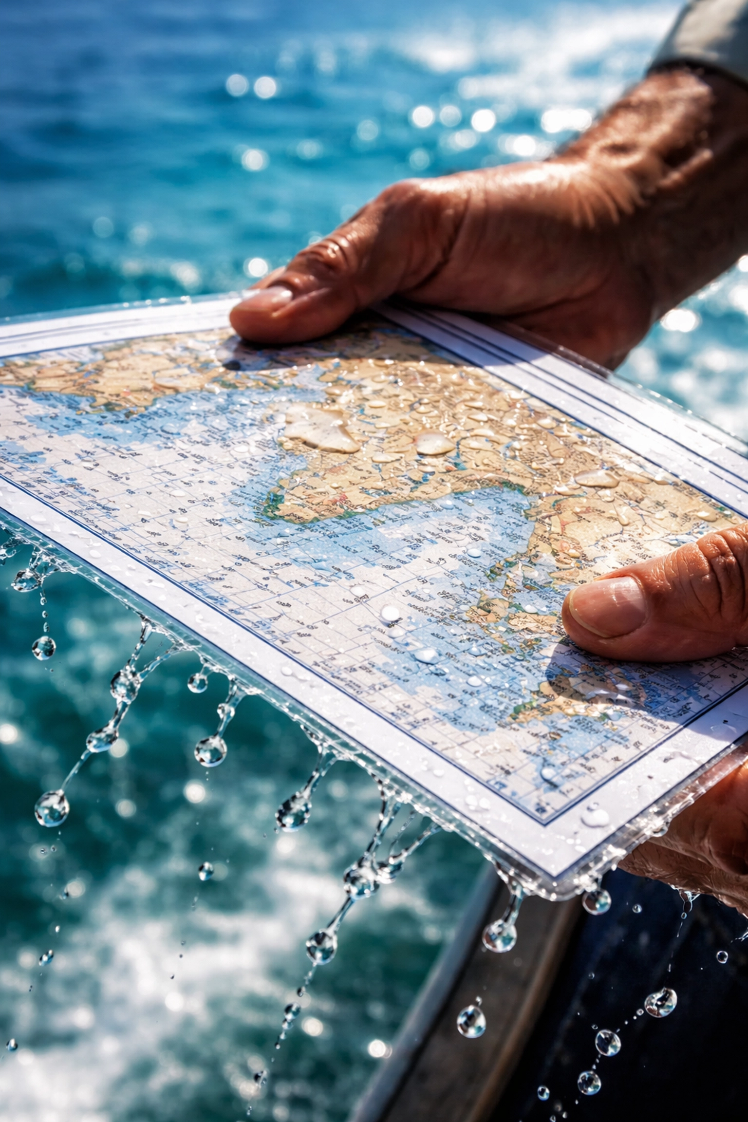
Each chart is 11×17 inches. Double-sided. That's a manageable size. It fits in your hands. It fits on your helm. It fits in standard storage compartments.
No more wrestling with oversized rolled charts. No more torn corners. No more water damage.
You can use these charts in any weather. Any conditions. Any coast.
Write On Them. Wipe Them Clean.
Here's something useful. You can write directly on our charts with markers.
Plot your course. Mark waypoints. Note hazards. Record observations.
Then wipe it clean. Start fresh for your next trip.
This feature is practical for:
- Planning routes before departure
- Marking fishing spots
- Noting changes you observe on the water
- Teaching navigation to crew members
Traditional paper charts? Write on them once. They're marked forever. Our laminated charts give you flexibility.
Nationwide Coverage. Every Coast. Every Waterway.
We cover the entire United States. Atlantic. Pacific. Gulf. Great Lakes. Inland waterways.

Maine to California. Alaska to Florida. The Great Lakes to the Gulf of Mexico. We have charts for all of it.
Planning a trip down the East Coast? We've got you. Exploring the Pacific Northwest? Covered. Fishing the Gulf? Check. Cruising the Great Lakes? Yes.
You can browse our complete selection at our shop.
Some examples of our coverage:
- Great Lakes: Charts like our Grand Haven, Michigan and White Lake, Michigan charts
- Gulf Coast: Coverage from Texas to Florida, including Tampa Bay to Sarasota
- Atlantic Coast: Full coverage from Maine down to the Keys
- Pacific Coast: California, Oregon, Washington, and beyond
Wherever you boat in the U.S., we have the charts you need.
Voted #1 Since 1996
We've been voted the #1 most popular navigation chart since 1996. That's not an accident.
Boaters trust us. For good reason.
Over 35 years of boating expertise goes into every chart we produce. We understand what you need on the water. We design our products for real-world use.
Our charts aren't made by people who sit in offices. They're made by boaters for boaters.
Who Benefits From Physical Charts?
Everyone on the water.
Cruisers: You're covering long distances. Multiple regions. Weather changes. Electronics can fail far from help. Physical charts are your insurance policy.
Fishers: You know your spots. Mark them on the chart. Wipe clean when someone's watching. Keep your secrets safe.
Kayakers and Small Boat Operators: Space is limited. Our 11×17 format fits perfectly. No electronics to worry about. No batteries to charge.
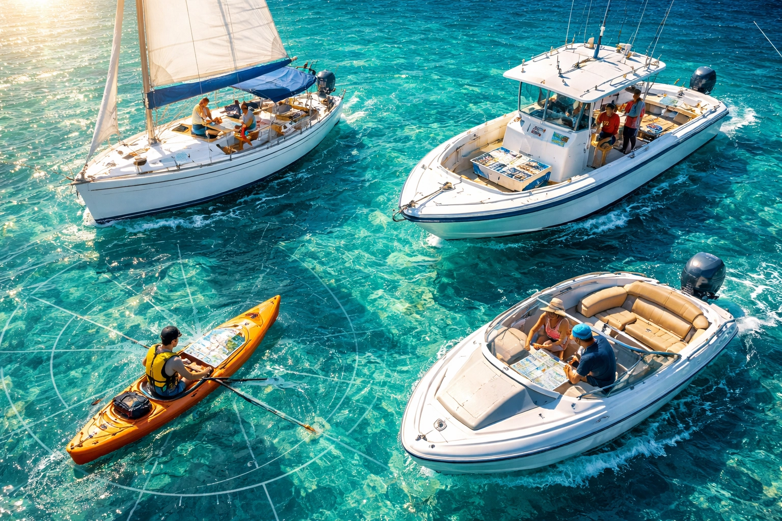
Sailing Enthusiasts: Traditional navigation skills matter. Physical charts keep those skills sharp. They also save you when technology fails mid-passage.
Weekend Boaters: Maybe you don't need charts every trip. But when you need them, you really need them. Keep a set on board. Just in case.
Charter Captains and Professionals: Backup navigation isn't optional. It's required. Our charts meet that need perfectly.
Learning Navigation the Right Way
Want to really understand navigation? Start with physical charts.
Electronic chartplotters do the work for you. That's convenient. But it doesn't teach you anything.
Physical charts force you to learn. You understand depths. You read symbols. You calculate distances. You plan routes manually.
These skills matter. When your electronics fail, knowledge saves you.
Many navigation courses still use paper charts for instruction. There's a reason for that. They're the best learning tool available.
Simple Storage. Easy Access.
Remember those bulky rolled charts? Forget them.
Our 11×17 double-sided format changes everything. Store them flat. Stack them in a drawer. Keep them in a waterproof bag.
Grab the one you need. Use it. Put it back.
No unrolling. No fighting with curled edges. No dedicated chart storage taking up valuable space.
This matters on smaller boats. Space is precious. Our charts respect that.
The Bottom Line
GPS is your primary navigation tool. We're not arguing that.
But smart boaters carry backup. Physical charts are that backup.
Our charts are:
- Waterproof and laminated
- 11×17 double-sided for easy handling
- Write-on, wipe-off capable
- Available for every U.S. coast and waterway
- Compact and easy to store
We've been the #1 choice since 1996. Over 35 years of expertise backs every chart.
Don't get caught without backup. Check out our full selection and find the charts for your waters.
Stay safe out there.