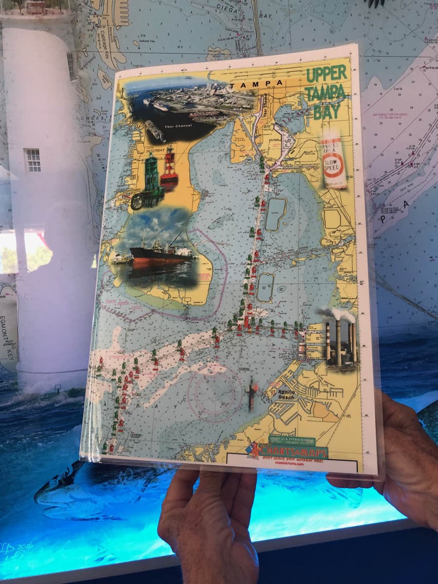
Tampa Bay Nautical Charts – Upper and Lower
October 3, 2019
Fort Pierce to Jensen Beach Nautical Chart
October 3, 2019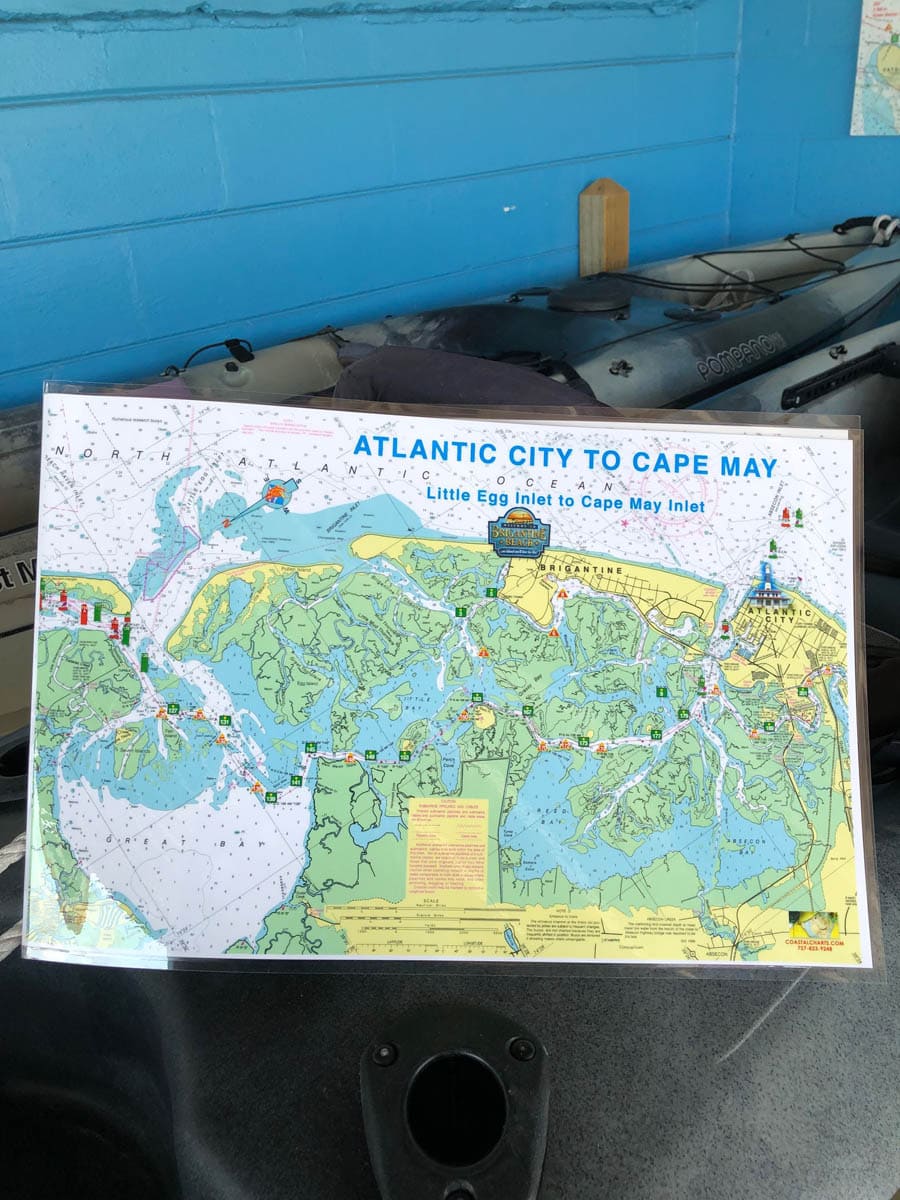

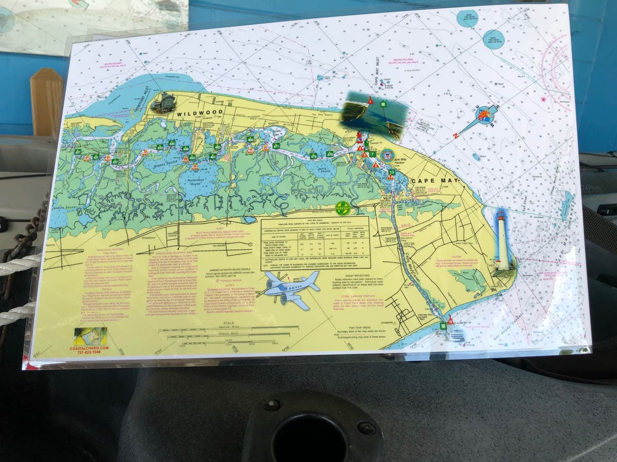
Atlantic City to Cape May Nautical Chart
$26.00
Atlantic City to Cape May Chart showing Little Egg Inlet to Cape May Inlet from the Atlantic Ocean. The Intracoastal Waterway has highlighted markers for easier navigation along with photographic visuals. The chart measures 17″ x 11″ closed and 34″ x 11″ open. Full uv lamination at 10 mil. “Write-On Wipe-Off! Time after Time” with a Sharpie marker and alcohol. Used by Coast Guard and coast Guard Auxilliaries, Marinas, Boat Rentals, Boat Clubs, County Sheriffs, Insurance companies, Real Estate and more! Easiest Boating Chart You Will Ever Use
Additional information
| State |
|---|
Reviews 0


Reviews
There are no reviews yet.