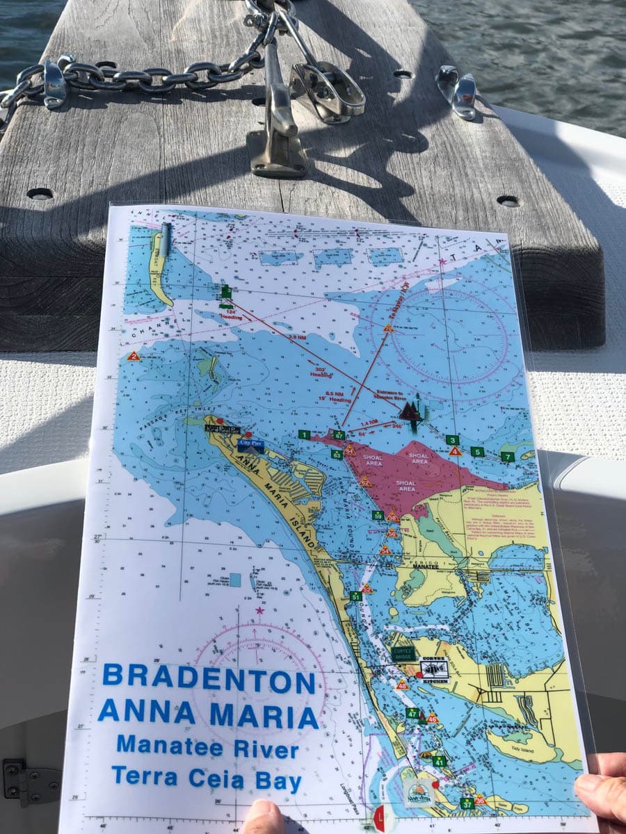
Bradenton, Anna Maria, Manatee River and Terra Ceia Bay Nautical Charts
October 3, 2019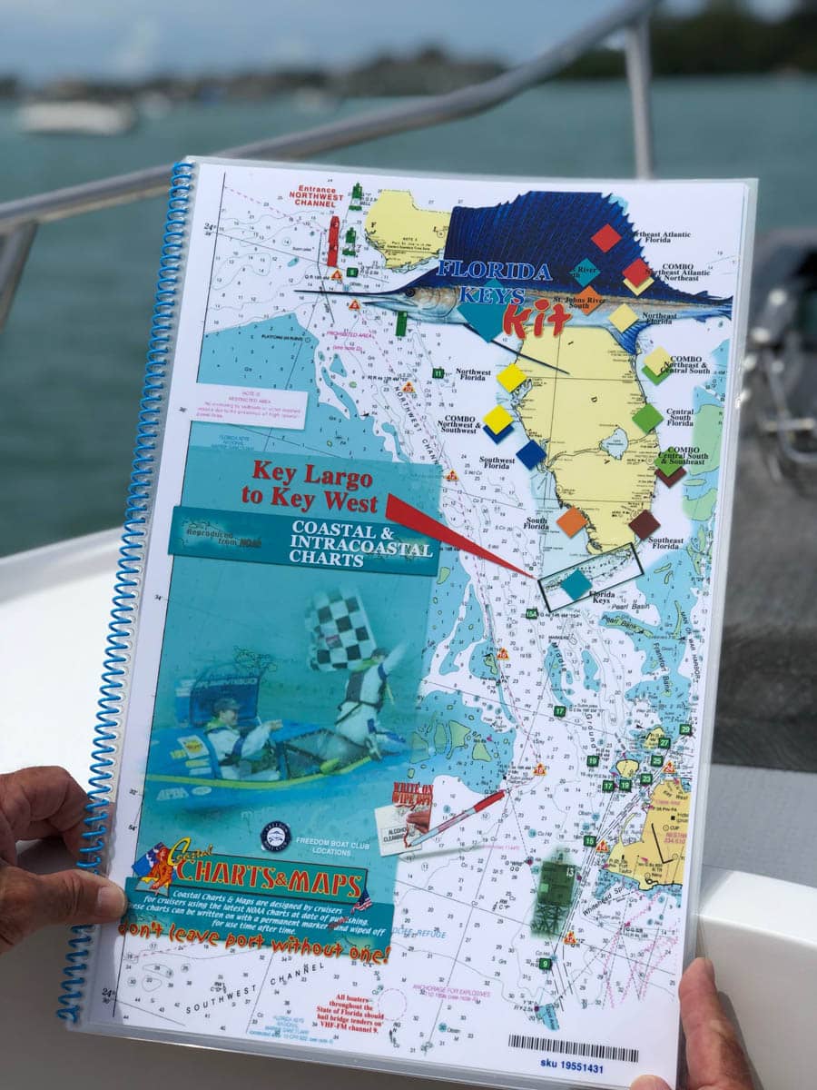
Key West to Key Largo Nautical Chart
October 3, 2019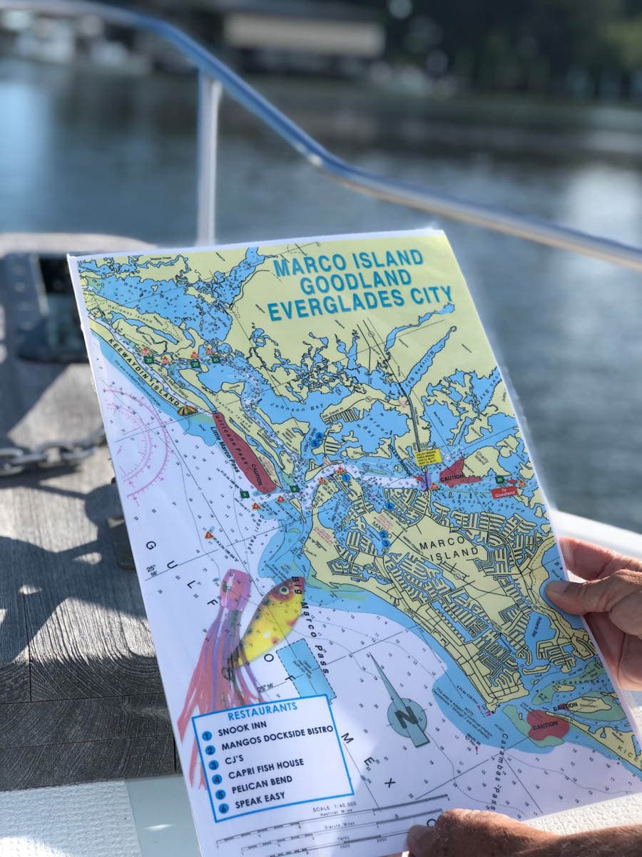
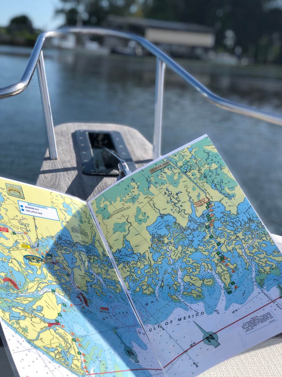
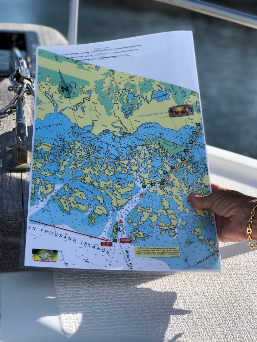
Marco Island, Goodland, Everglades City Nautical Chart
$26.00
Keewaydin Island south to Marco Island, Goodland and Everglades City. Caution areas are highlighted and also a few local restaurants. Enlarged navigation markers along with photographic visuals. The chart measures 11″ x 17″ closed and 22″ x 17″ open. Full uv lamination at 10 mil. “Write-On Wipe-Off! Time after Time” with a Sharpie marker and alcohol. Used by Coast Guard and coast Guard Auxilliaries, Marinas, Boat Rentals, Boat Clubs, County Sheriffs, Insurance companies, Real Estate and more! Easiest Boating Chart You Will Ever Use
Additional information
| State |
|---|
Reviews 0

Reviews
There are no reviews yet.