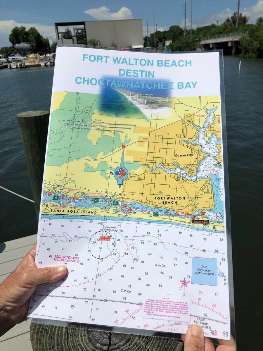
Choctawhatchee Bay Nautical Chart – Fort Walton Beach and Destin
October 3, 2019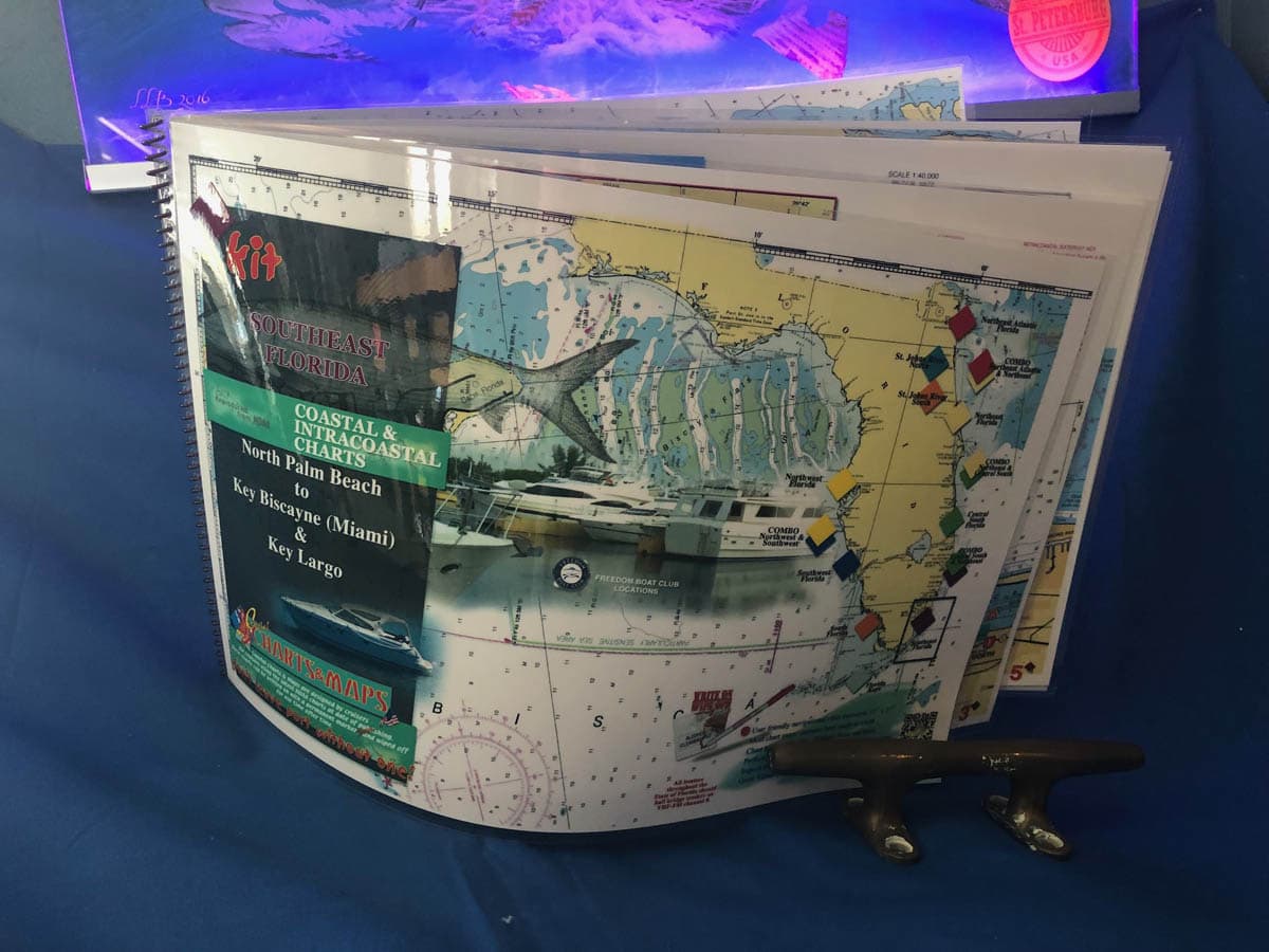
Southeast Florida Nautical Chart Kit – North Palm Beach to Key Biscayne, Miami Beach and Key Largo
October 3, 2019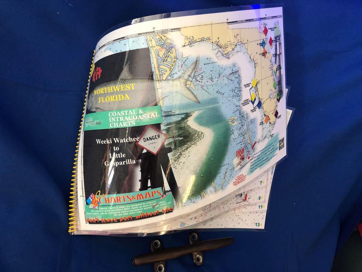

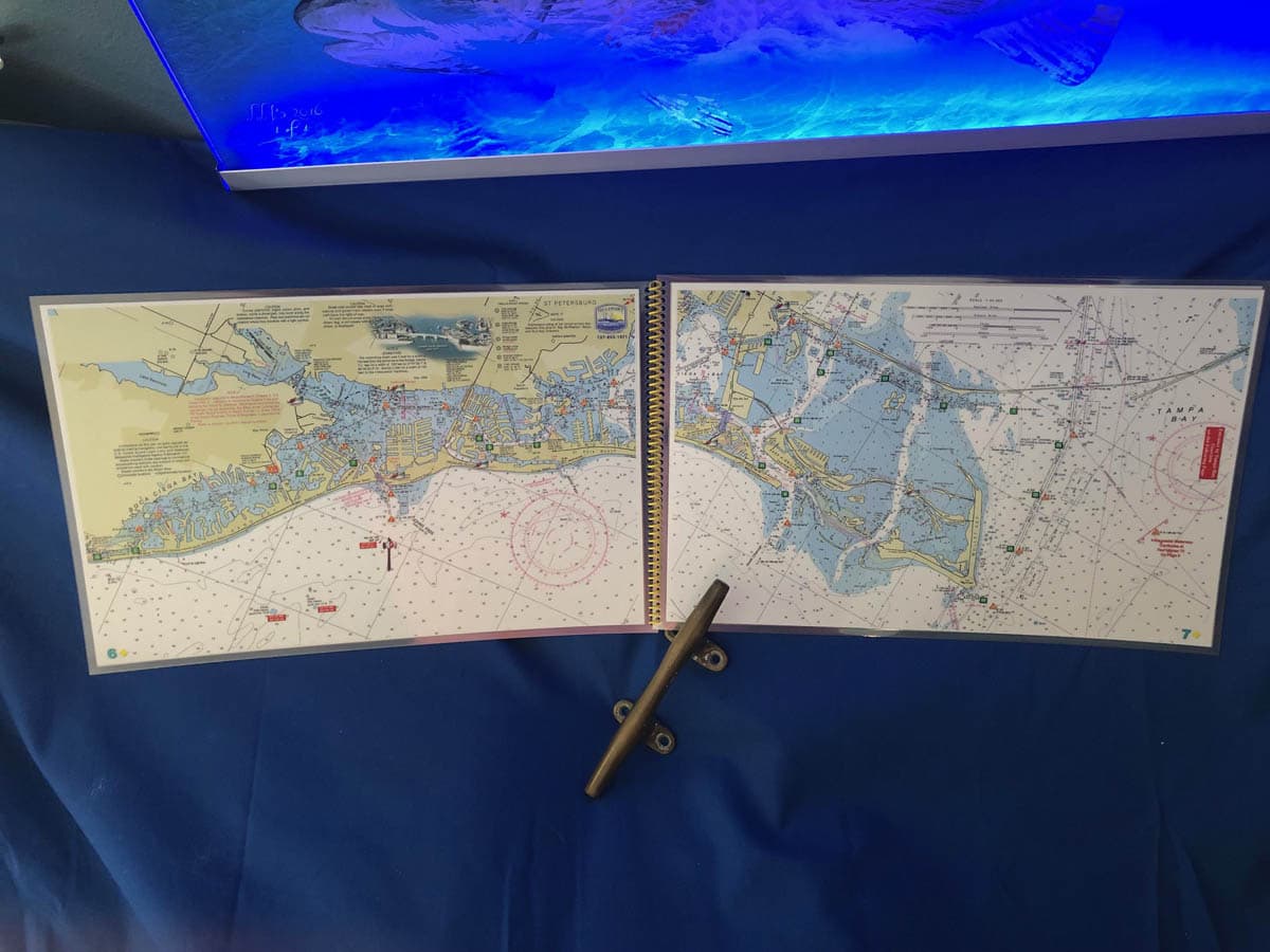
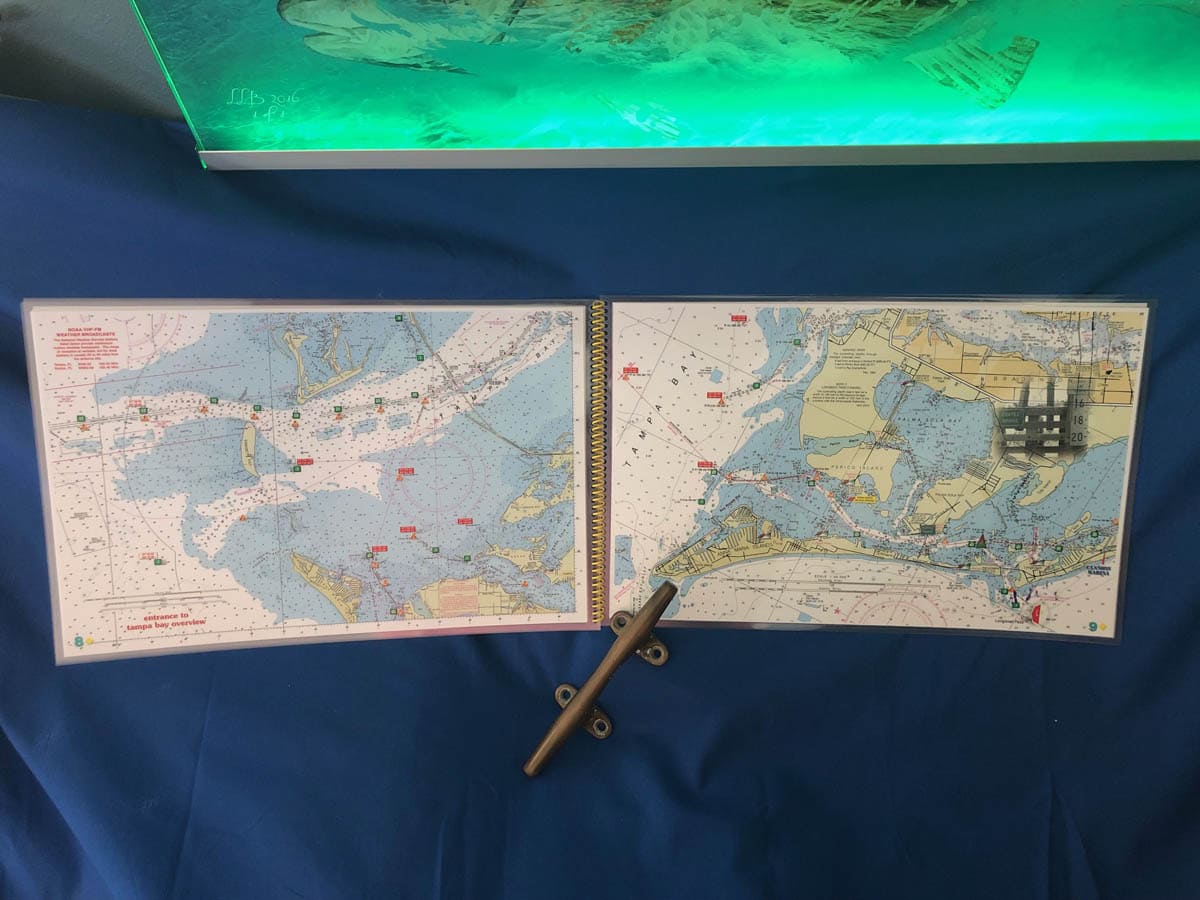
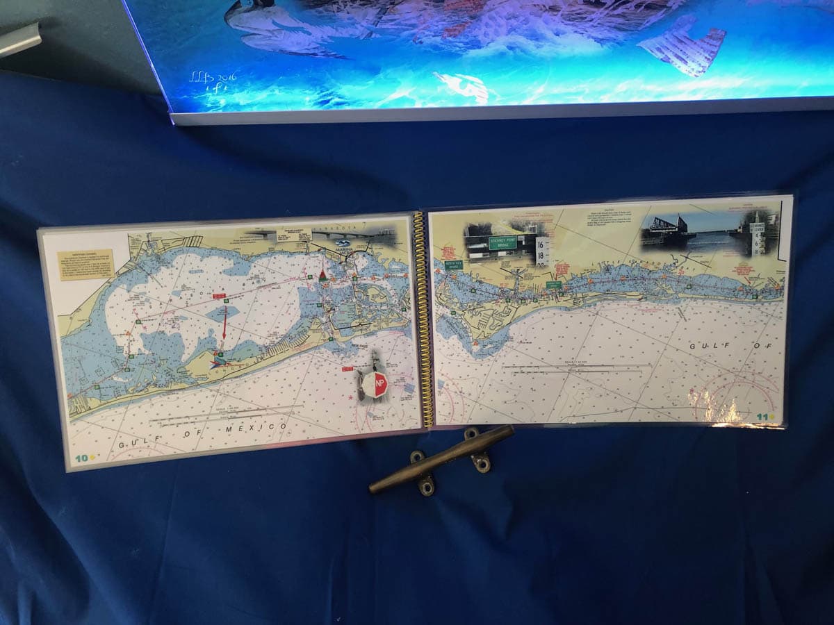


Northwest Florida Nautical Chart Kit – Tarpon Springs to Gasparilla Island
$60.00
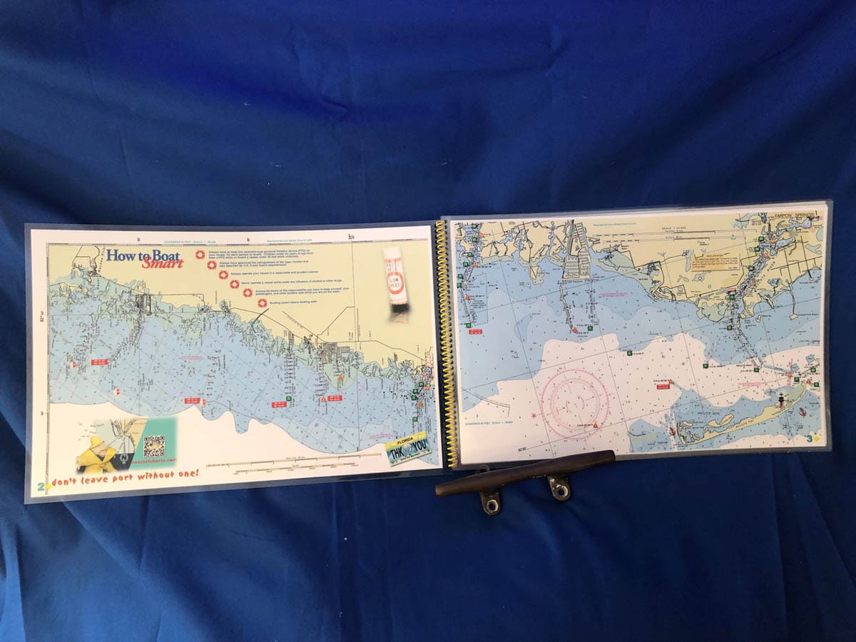
The Northwest Florida Coastal Chart Kit starts with a 1:80,000 scale chart of Weeki Wachee. The balance of the chart kit is 1: 40,000 scale traveling south from Port Richey, Tarpon Springs and Clearwater navigating the intracoastal waterway to the mouth of Tampa Bay and the beautiful Sunshine Skyway Bridge. Crossing the mouth of Tampa Bay to the Manatee River or to Longboat Key, Sarasota and south as far as Venice and Gasparilla Island. Enlarged navigation markers along with photographic visuals. Each page of the chart kit measures 17″ x 11″. Full uv lamination at 10 mil. “Write-On Wipe-Off! Time after Time” with a Sharpie marker and alcohol. Used by Coast Guard and coast Guard Auxilliaries, Marinas, Boat Rentals, Boat Clubs, County Sheriffs, Insurance companies, Real Estate and more! Easiest Boating Chart You Will Ever Use
| State |
|---|
Reviews
There are no reviews yet.