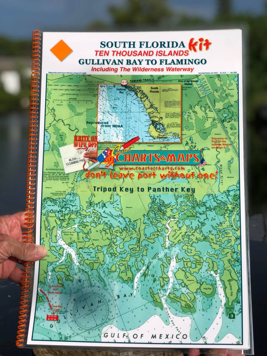
South Florida Nautical Chart Kit – Ten Thousand Islands Gullivan Bay to Flamingo Including the Wilderness Waterway
October 3, 2019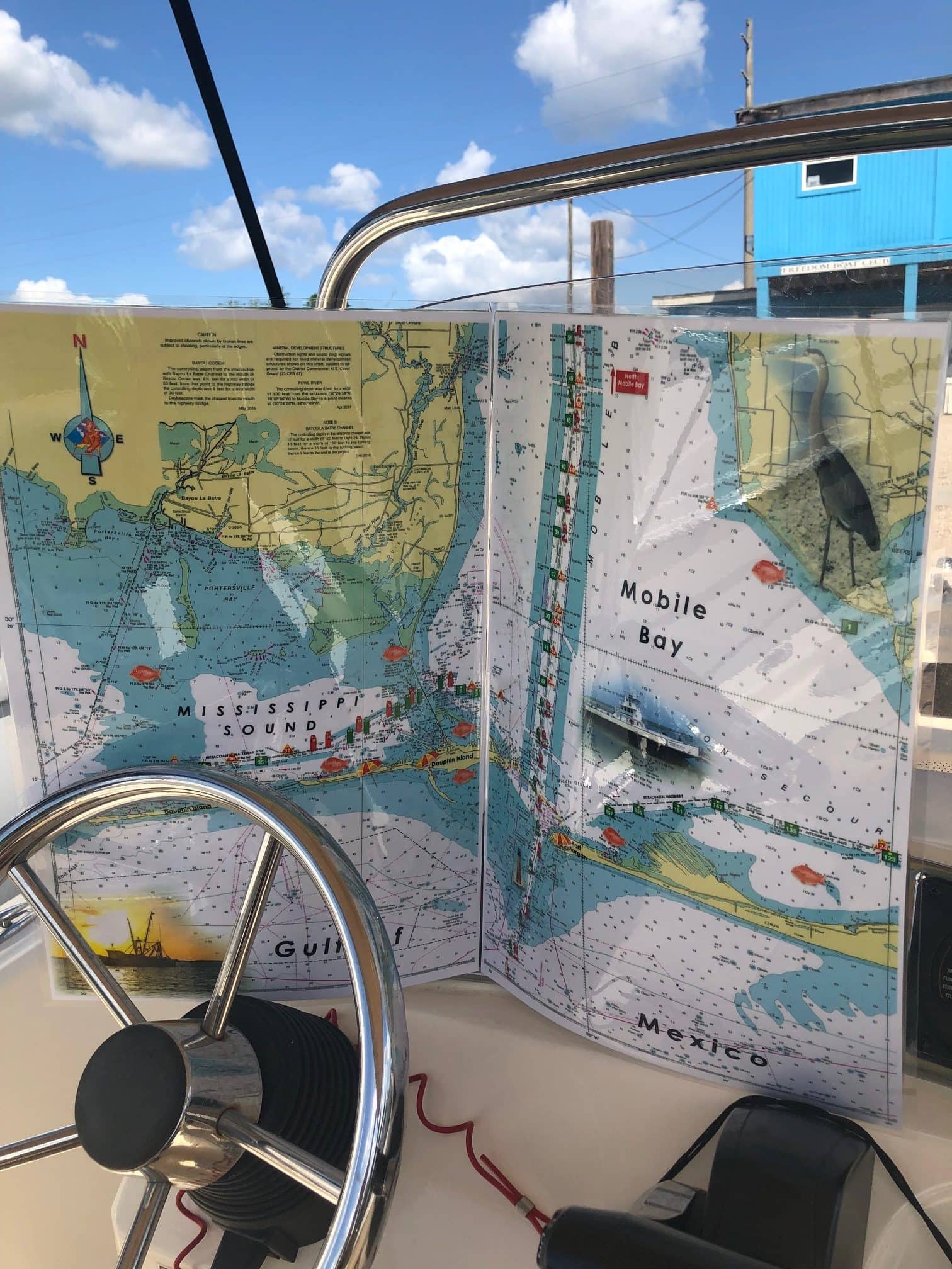
Mobile Bay Alabama Nautical Chart
November 5, 2019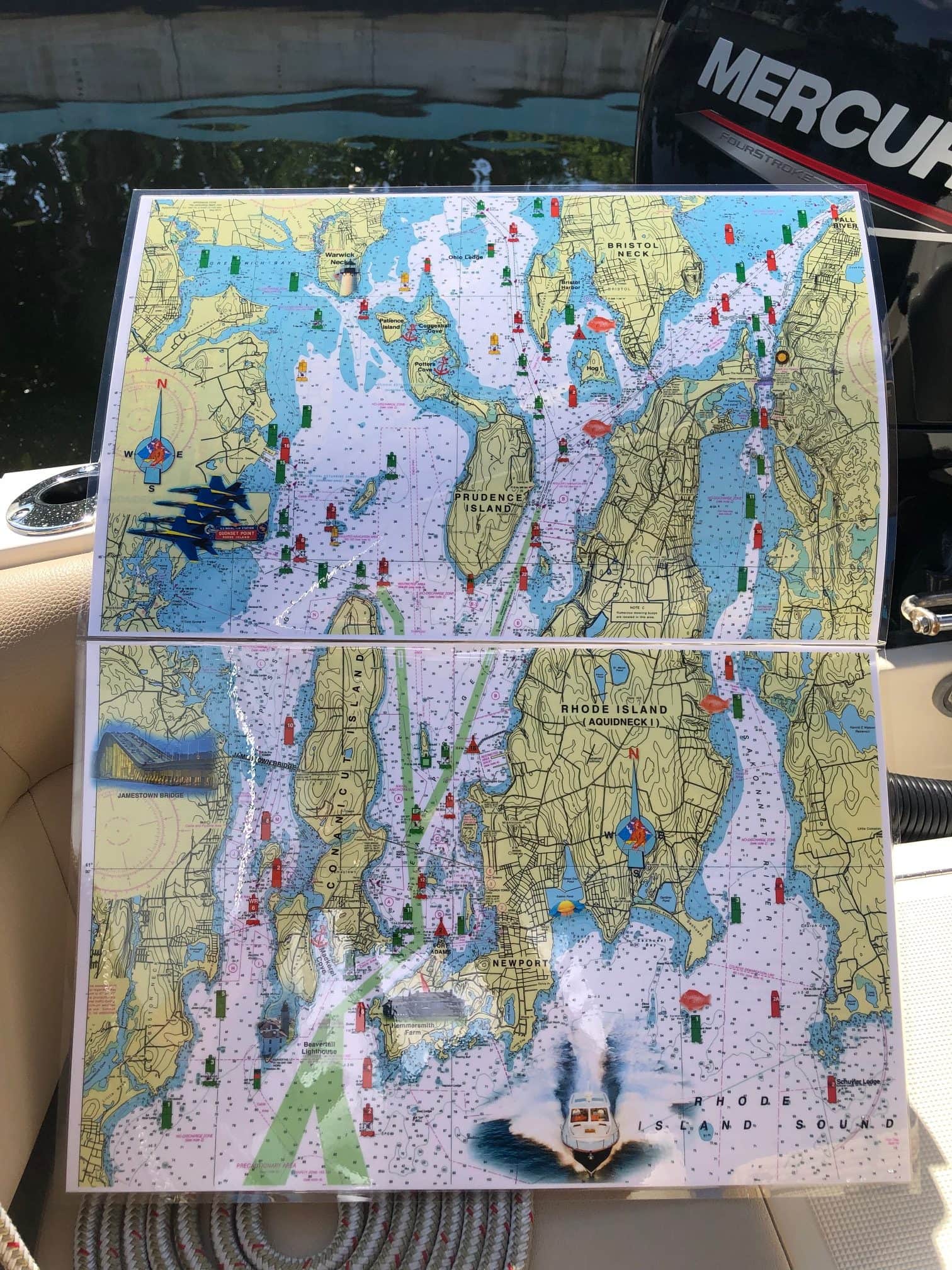

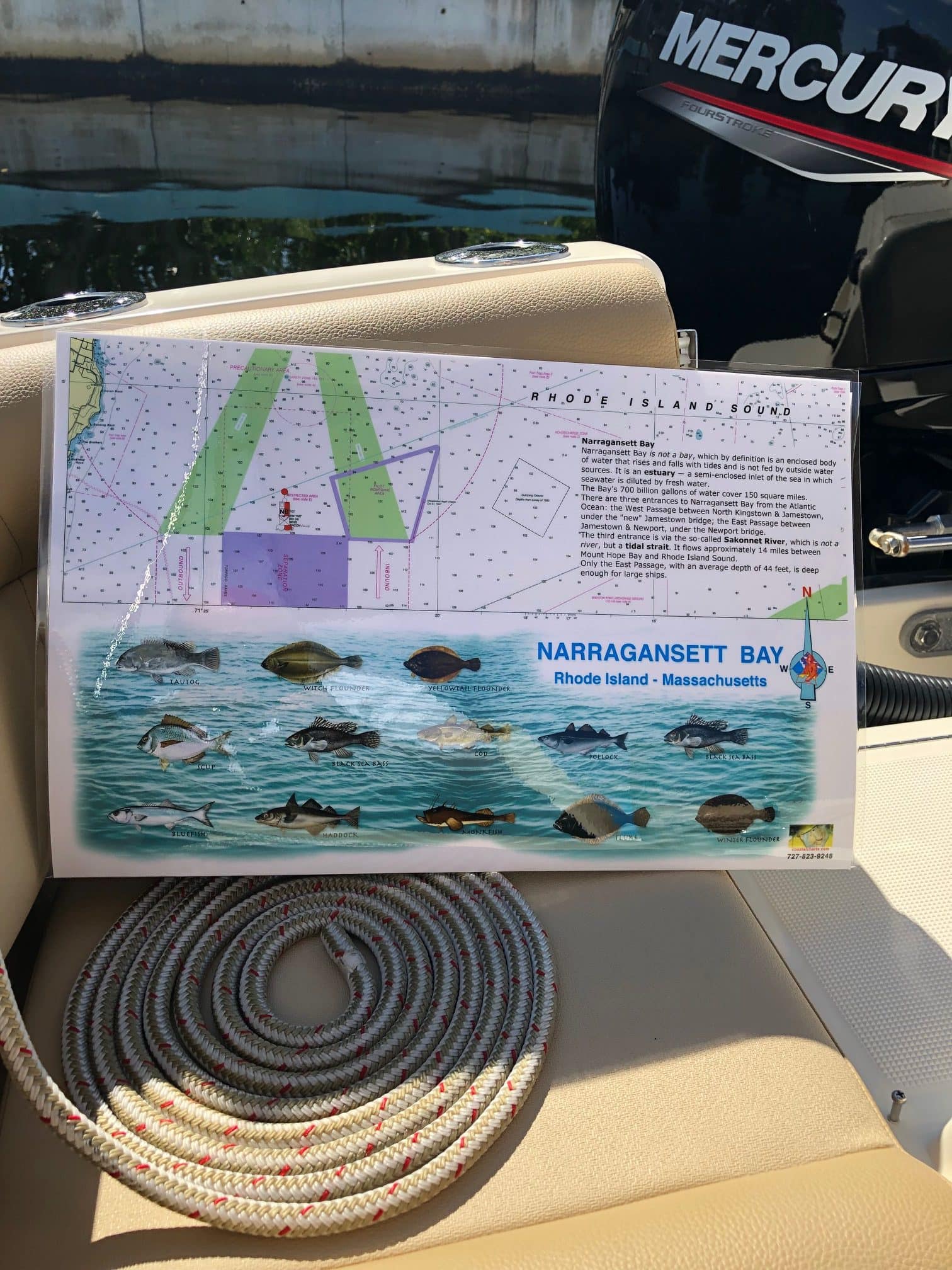
Rhode Island Nautical Chart
$26.00
This 2 page chart covers all of Narragansett Bay north of Rhode Island Sound. From Newport to Providence. Small parts of it extend into Massachusetts. Enlarged navigation markers along with photographic visuals. Each page of the chart measures 17″ x 11″. Full uv lamination at 10 mil. “Write-On Wipe-Off! Time after Time” with a Sharpie marker and alcohol. Used by Coast Guard and Coast Guard Auxilliaries, Marinas, Boat Rentals, Boat Club, County Sheriffs, Insurance Companies, Real Estate and more. Easiest Boating Chart You Will Ever Use
Additional information
| State |
|---|
Reviews 0


Reviews
There are no reviews yet.