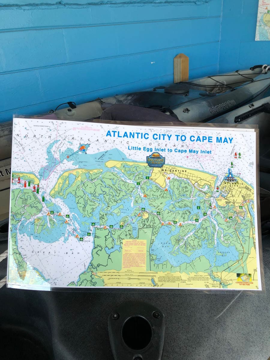
Atlantic City to Cape May Nautical Chart
October 3, 2019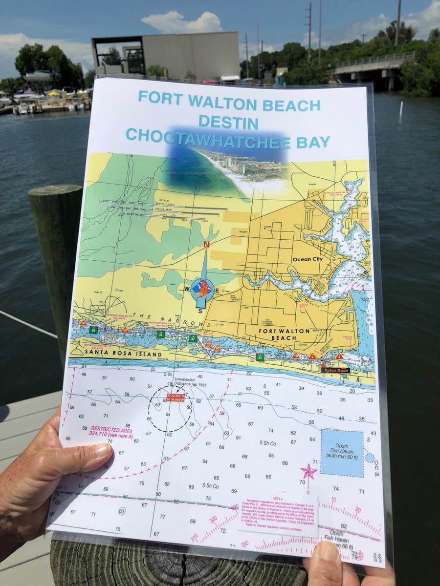
Choctawhatchee Bay Nautical Chart – Fort Walton Beach and Destin
October 3, 2019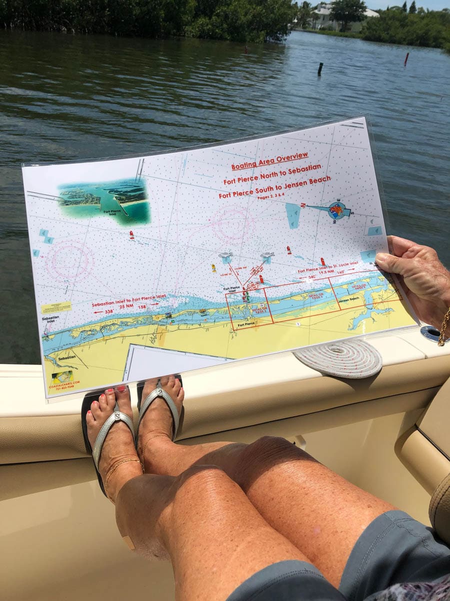
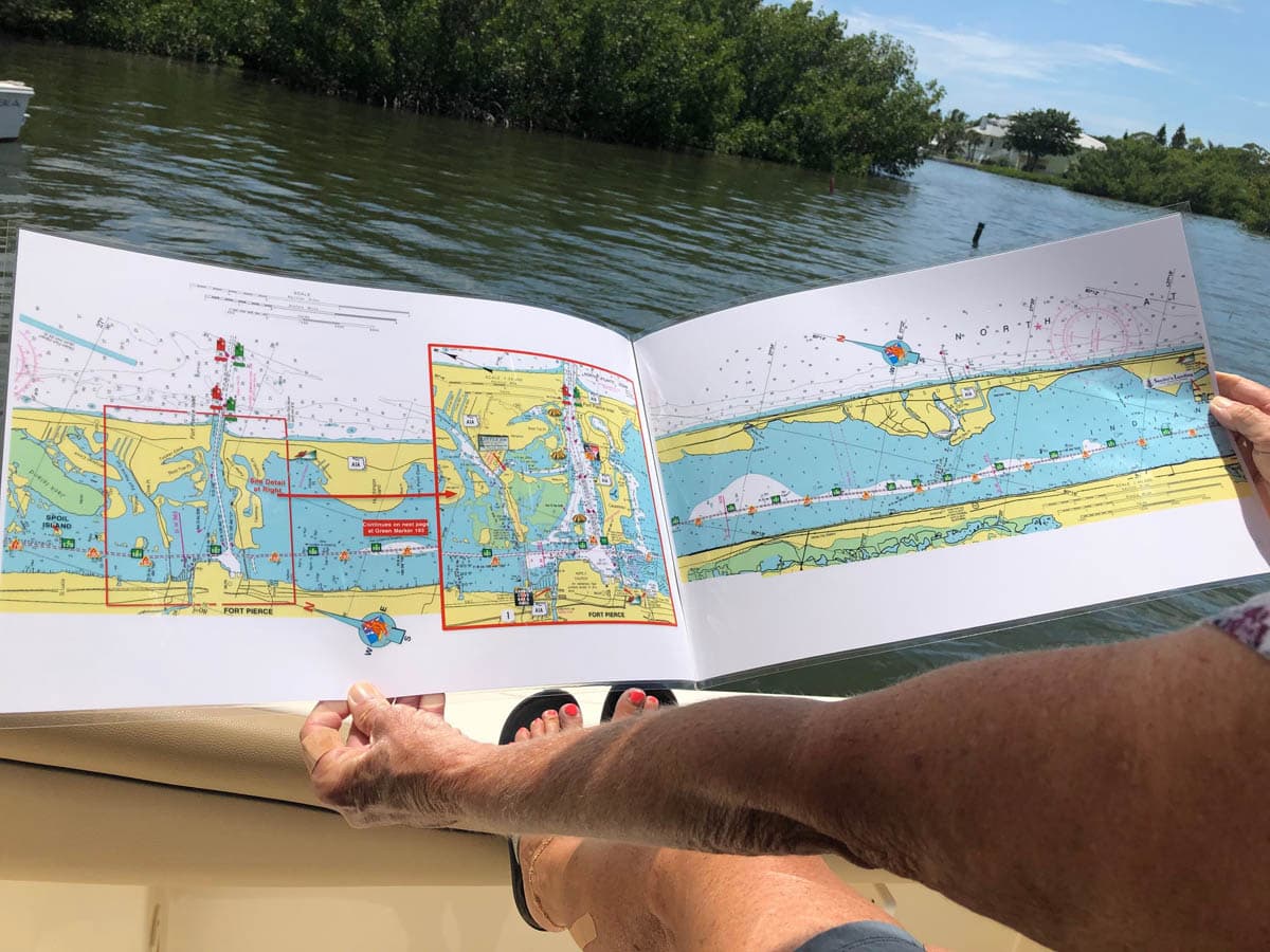

Fort Pierce to Jensen Beach Nautical Chart
$26.00
The front cover of this chart is a boating area overview from Fort Pierce Inlet North to Sebastian Inlet and Fort Pierce Inlet South to St. Lucie Inlet. This overview also shows mileage to a few fish havens. The inside of the chart and the back cover show detailed information from Fort Pierce to Jensen Beach and the St. Lucie Inlet. The chart measures 17″ x 11″ closed and 34″ x 11″ open. Full uv lamination at 10 mil. “Write-On Wipe-Off! Time after Time” with a Sharpie marker and alcohol. Used by Coast Guard and coast Guard Auxilliaries, Marinas, Boat Rentals, Boat Clubs, County Sheriffs, Insurance companies, Real Estate and more! Easiest Boating Chart You Will Ever Use
Additional information
| State |
|---|
Reviews 0

Reviews
There are no reviews yet.